RotorWorks, LLC
LiDAR - Video - Photogrammetry - Survey - Inspection - Patrols
  • Home
  • About
  • Industries
    • Power Line
    • Telecom
    • Environmental
    • Pipeline
    • Transportation
  • Services
    • Aerial Mapping
    • Aerial Video
    • Infrared & Corona
    • Visual Inspections
    • Data Analysis & GIS Services
    • Emergency Response
    • LiDAR Mapping
    • Storm Patrols
  • Aircraft
  • Contact
  • Clients

Data Analysis & GIS Services

Picture
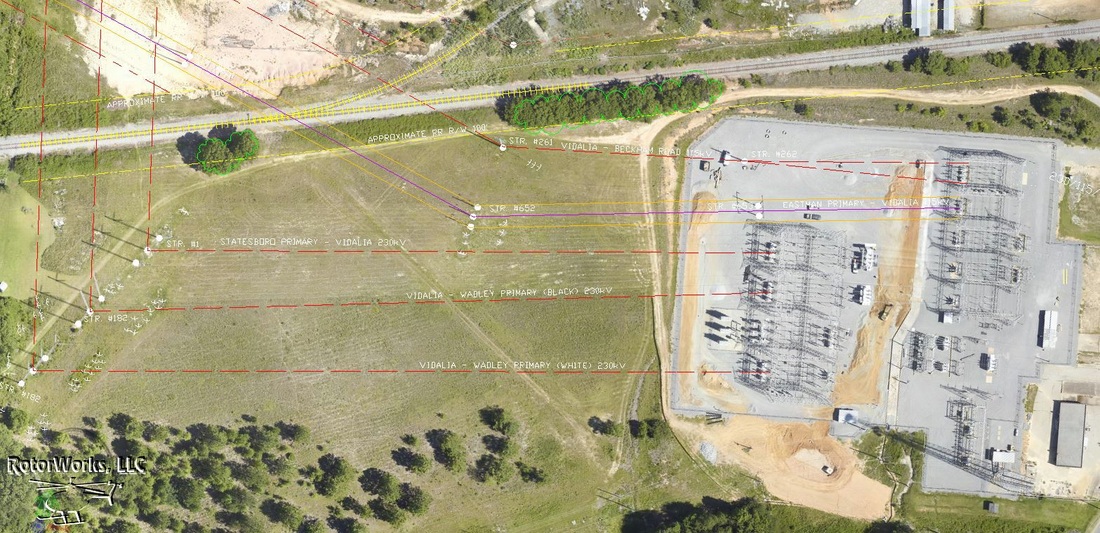
RotorWorks is able to deliver our clients end-to-end solution with GIS-ready remote sensing deliverables. We offer classification of LiDAR, derivative products and aerial imagery processing. 

Picture
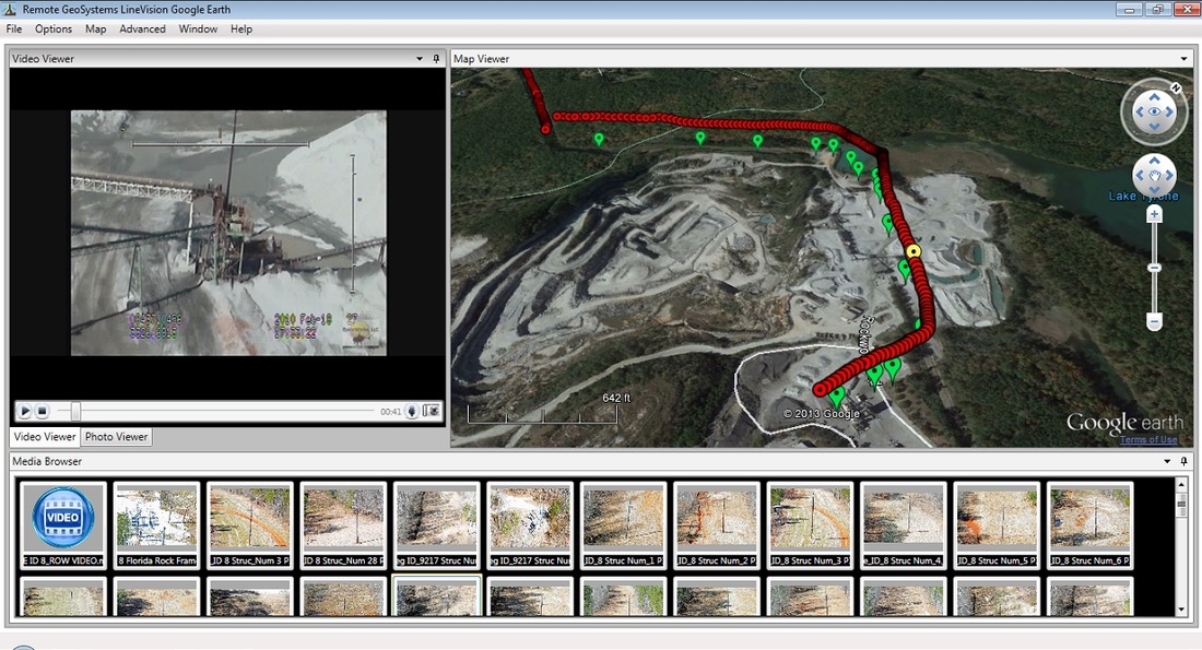
Video and still photos collected from our gyro-stabilized gimbals is automatically geo-tagged in-mission and is instantly ready for "track-based" playback on a map using popular GIS and CADD software such as Esri ArcGIS, Google Earth and PLS-CADD.      

Services
IR & Corona Video Inspections
LiDAR Mapping


Resources
Rotor Resources, LLC

2014 Copyright RotorWorks, LLC